Your personal marine navigation
Every subscription makes the sea safer.
The chart, the AIS traffic, the anchor watch and the distress screen stay free for every sailor. Premium is what keeps them free.
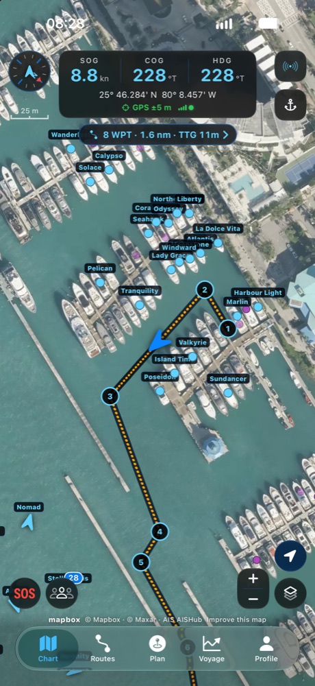
Worldwide offline charts. Your position, course and speed at the helm. Live ship traffic, wind and sea, and an anchor watch that wakes you. No signal required.
Open Sirena Seafarer, tap Fleet, then Invite, and enter this code. If you do not have the app yet, download it from the App Store first.
Rebuilt from the ground up for iPhone and iPad, with a companion for Apple Watch.


Open the app once with your position and the chart of the waters around you (about 40 km) is saved on your phone, automatically, and again as you move on. Lose signal and the chart keeps drawing.
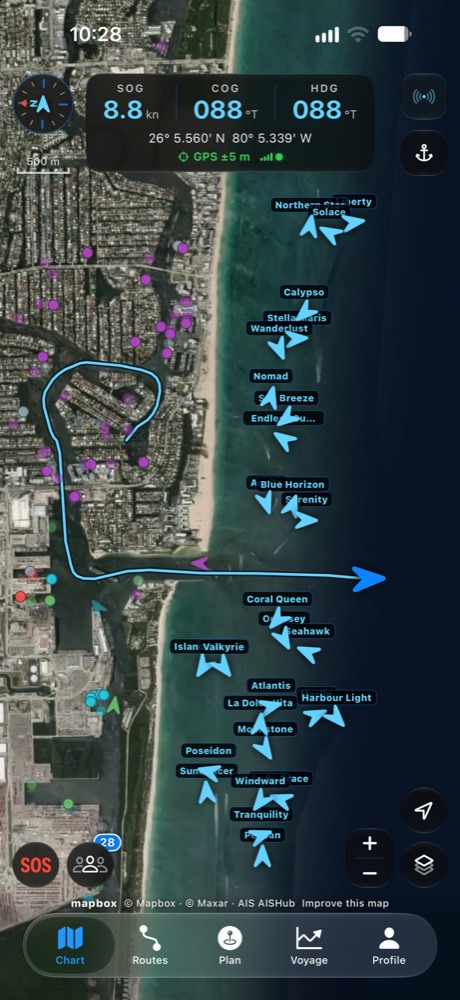
AIS vessels around you, coloured by type, with name, speed and heading. Free, not a paid add-on.
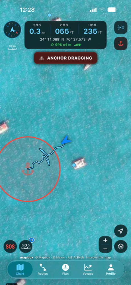
Set the swing circle and sleep. If the boat drags, the alarm sounds even with the phone locked and the ringer on silent, and on your Apple Watch.
See the captains you sail with, wherever they are. Invite with a QR code, a link, or a phone number. Strangers only ever see an anonymous boat, and only if you choose to share.
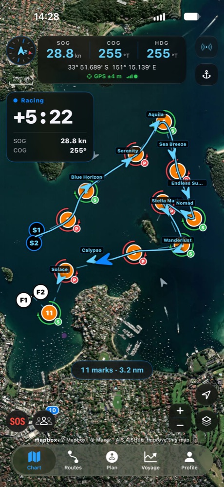
Draw a course, share it with your fleet, and race to a 5-4-1-0 start clock with a Sync button for the committee's signal, on your phone and on your wrist.
Forecast arrows you can scrub hour by hour, routes with distance and ETA at your real speed, and every voyage logged as a standard GPX file.
The sea does not ask who paid. A chart, the traffic around you and an alarm that wakes you when the anchor drags are safety, so they stay free, for every sailor, with no expiry.
Premium and the world chart are what keep them free. They pay for the charts and for the servers that carry them to a phone with no signal.
Crossing to another country, or sailing where there is no signal for days? The whole world's Sirena Seafarer chart, about 1.1 GB, downloaded to your phone on Wi-Fi. One payment, it never renews.
Everything above stays free for good. Premium adds the charts that cost us money to carry, and every new phone gets Premium free for its first 7 days, no payment.
High-resolution imagery for reading an unfamiliar anchorage or a shallow entrance before you commit to it.
Traffic separation schemes: the shipping lanes and their separation zones, by day and by night.
United States waters from NOAA's own electronic chart data (not an official chart).
The Light chart and the detailed OpenStreetMap charts, by day and by night.
The annual plan is shared with your Apple Family group, up to six people. Everyone aboard gets the same charts. No second account, no second subscription.
The monthly plan can start with a 7-day free trial through Apple. Unless you cancel at least 24 hours before it ends, it converts to $14.99 a month. Manage or cancel in Settings, Apple Account, Subscriptions.
Yes. Open the app once with your position and the chart of the waters around you (about 40 km) is saved on the phone automatically; the whole world is a one-time $49.99 download. After that your position, course and speed, the chart, your route and the anchor watch all run from the phone.
The Sirena Seafarer chart with the offline chart of your waters, live AIS ship traffic, wind and sea forecast, routes and waypoints, the voyage track log with GPX export, the fleet, regattas with the start clock, the anchor watch alarm, the Apple Watch app, and distress assist. None of it expires.
The premium charts: high-resolution satellite imagery, the TSS charts showing shipping lanes and separation zones, NOAA chart data for US waters, and the Light and OpenStreetMap charts. The monthly plan can start with a 7-day free trial through Apple.
No, and no phone app should be. Sirena Seafarer is an aid to situational awareness, not an approved navigation system. It does not replace official nautical charts, publications and good seamanship, and you should always cross-check before making a navigation decision.
The base chart is our own render of OpenStreetMap data, hosted by us and credited under the ODbL licence in the app. Satellite imagery comes from Mapbox and from our own Sentinel-2 coastal imagery. AIS traffic comes from AISHub and aisstream.io.
The annual plan does. It is Family Sharing enabled, so one subscription covers up to six people in your Apple Family group. The monthly plan is for a single Apple Account.
In Settings on your iPhone, under your Apple Account and then Subscriptions. Cancel at least 24 hours before the period ends and it will not renew. There is nothing to email us about.